Mangatangi Trig Hike Plan

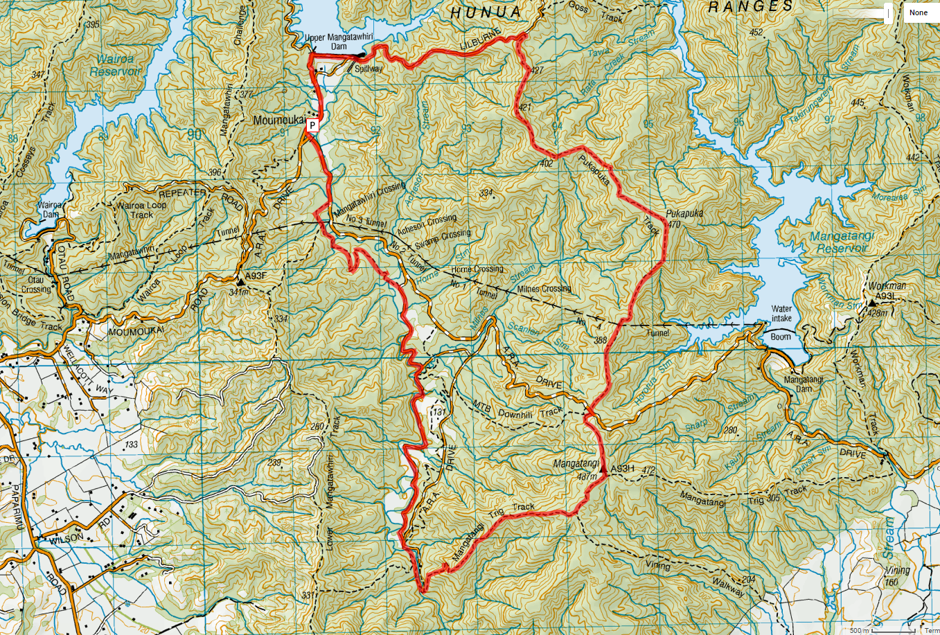
Rough Basic outline: Starting from Moumoukai Car park. Walk up Lilburne Road (past Upper Mangatawhiri Dam), Turn right onto Pukapuka Track. Walk up to Mangatangi Trig, Then walk down Mangatangi Trig Track and return back to car via network of gravel road.

If necessary, can cut this short by going down A.R.A Road.

Alternative shorter southern loop plan: Go up A.R.A Road, down Mangatangi Trig Track and back to car park via the network of roads.

Estimated Time: 8-10 Hours (Depending on pace, including allowances for stops)


Mangatangi Trig Hike Plan

Marawhara Hike Plan

A possible plan for a stream bash and Hike. North Piha, Waitakare ranges

Weather dependency… Will go if there is a little bit of showers, though if there has been a lot of rain preceding the chosen date, the hike will be cancelled. Not a safe one to do with torrential swollen streams.

The stream section is quite slow going.  Expect to be in the stream for about 4-5 hours + Hike along Maungaroa ridge / Anawhata Road (About 2½-3 hours to end of Hetig Track where the stream section starts)


Marawhara Hike Plan